By David Schaeffer, CEO & Founder of DSEL
Cost sharing is fundamentally about the measurement of land areas, which, when transcribed and “manipulated”, produces each owner’s share of the cost shared community assets.
To illustrate, many community services are shared based on each owner’s Net Developable Area (NDA). A typical definition of NDA would be the gross landholding area less the area of all non-developable lands.
The NDA is then used to determine each owner’s benefiting share of Community land and services. A typical definition of benefitting share is Individual owner NDA divided by total NDA of all owners participating in the cost sharing agreement”.
The speed and precision of measuring areas is of major importance in the practice of cost sharing. Cost sharing relies on measuring thousands of areas that form the basis for equitable community land use distribution and for calculating the benefit received by individual landowners for shared infrastructure and other community assets.
Here is a partial list of areas that must be measured by the cost sharing engineer:
- Each owner’s total land area
- Non-developable lands, including watercourses, woodlots, wetlands, buffers, road widenings, etc.
- Community uses, such as parks, schools, stormwater management (SWM) ponds, walkways, oversized roads, local roads adjacent to community use lands, transit hubs, utilities, etc.
- Tributary areas, such as each owner’s drainage area, contribute to each individual length of oversized pipe in the entire community – for storm drainage systems, sanitary sewer systems, clean water pipes, low impact development (LIDs), etc.
Furthermore, the communal land uses listed above typically sit on multiple ownership parcels. These must be further broken down to reflect each individual owner’s contribution to that specific feature. As an example, a school might cover a total area of 3.5 ha, but the school may be situated on three separate ownership parcels, each with a unique land contribution. Together, these parcels comprise the complete 3.5 ha. school block.
And it is also not one size fits all. Different community assets are typically shared differently, and therefore, each asset must be tracked separately. As an example,
- Schools, oversized roads, etc., are generally shared based on net developable area.
- The required parkland contribution varies based on the underlying land use areas on that owner’s land.
- Stormwater Management ponds, LIDs, and oversized storm pipes are generally shared based on the contributing drainage area multiplied by flow generation characteristics.
- Sanitary pump stations, forcemains, and sanitary sewers and generally shared by design population, which is the contributing area multiplied by population density.
- Intersection improvements are generally shared on net developable areas or design traffic generation counts.
Current practice still typically involves recreating area boundaries, followed by computer-generated area calculations. The results are subsequently entered manually into an Excel spreadsheet. As cost sharing agreements have evolved, both the number of shared items and the complexity of the calculations have increased. It is not unusual to have hundreds of pages of cost sharing sheets in a large community, with each item’s share ultimately linked to the measurement of land areas.
A brief history of measuring areas
I graduated from engineering school way back in 1981 and landed my first job at a consulting firm on Vancouver Island. I was given numerous junior tasks that were appropriate for my knowledge and experience, which was zero.
One such job involved measuring road areas on engineering drawings for quantity certifications and land areas on infrastructure planning drawings for cost sharing of infrastructure. This activity fascinated me, mostly because of the tool I was given to complete the task. I had never seen a planimeter before, the state-of-the-art tool for measuring areas from scale drawings. Essentially, it was comprised of two arms, hinged together and able to pivot freely at the inflection point, allowing the free movement of the combined instrument.
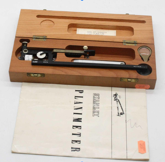
The end of one arm was held in a fixed location, while the end of the second arm included a pointer, which was manually guided by the practitioner along the lines of the irregular boundary surrounding the feature where the area was required. As the pointer moved, the device flexed, and the numerical scale fastened to the device rolled back and forth, not resting until the pointer returned to the starting point. The planimeter scale would then be read, indicating the mathematical areas within the closed irregular shape, which was then transcribed into the appropriate document.
After many hours of diligent tracing, I became very proficient in using the planimeter.
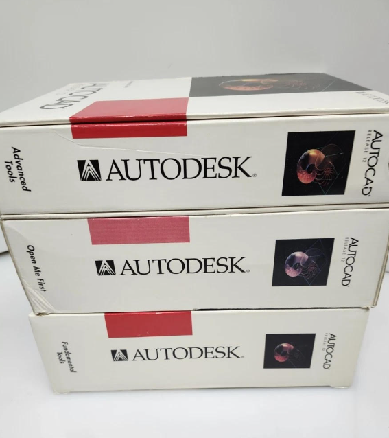
The planimeter became obsolete a decade or two later with the widespread introduction of personal computers and drafting software. Manual, physical tracing was replaced by manual, electronic tracing, where the operator joined electronic lines and arcs together to create the boundary, which was then mathematically calculated by software. The area would then be noted and transcribed into the appropriate document.
By replacing one manual task with another manual task, the measuring process wasn’t much faster. They both relied on the speed and skill offered by the practitioner doing the work.
Even now, 45 years after I was first introduced to the planimeter, the industry has not made significant advances. Cost sharing is still the product of endless, tedious area measurements and manual transcribing of these areas into individual Excel cells. As a result, the initial cost sharing calculations for a new community can take many months to prepare, and may even take a year or more for larger communities.
Current cost sharing practice is at odds with the explosion of technology we have witnessed over the last few years.
Easy Share is the new state-of-the-art
DSEL is excited to introduce Easy Share to the land development industry. Easy Share eliminates the need for manual measurement of myriad areas and manual transcription of the areas into the cost sharing tables.
Each area is automatically identified and measured in the AutoCAD drawing, extracted accurately, and comprehensively by cost sharing category, and entered into the cost sharing tables precisely.
This is a revolutionary and long overdue advancement in cost sharing. The advantages include:
- Reduce preparation time by several months.
- Improved accuracy due to comprehensive communal measurements.
- Visual checks ensure that all areas have been accounted for.
- Numerical checks confirm that the total of all areas is correct.
- Eliminate the need for manual data entry.
- Remove transcription errors.
- Enhance clarity in cost sharing by providing timely information to facilitate cost sharing discussions.
- Support the timely completion of the owners’ cost sharing negotiations offering requested information on various cost sharing strategies considered by the group.
Stay tuned for more advantages of Easy Share
Easy Share offers numerous advantages over traditional cost sharing approaches:
- Improved speed
- Enhanced precision
- Visual verification
- Numerical checking
- Automated and streamlined calculations of community land value
- Owner-specific presentation of cost sharing obligations
Please follow these posts for more insights into Easy Share, the next generation of cost sharing, where the above enhancements will be presented in further detail.
Call me to schedule a Demonstration
Feel free to contact me to schedule a a live demonstration of DSEL’s innovative, state-of-the-art cost sharing solution.
Accelerate your project… accelerate your community!